 June 2018
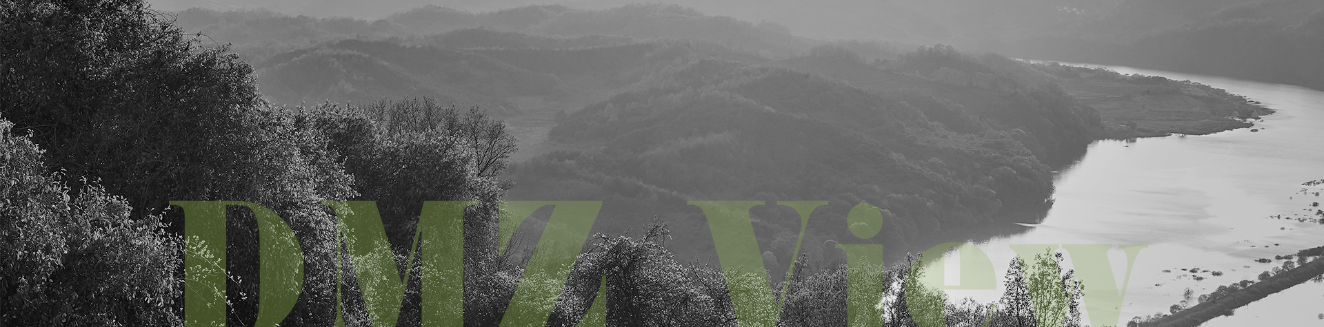
Contents


Free From Human Intrusion


Dreaming of Delightful Zone

Take You to the DMZ

Seeing With the Mind, Talking Through the Lens

the Design of Handheld Fans


Shared Together for Double the Happiness


Founded in the Spirit of Candlelight
Land of Nature,
Free From Human Intrusion
Lift the veil, enter the Demilitarized Zone (DMZ) and behold the primitive beauty of pristine nature thriving within. This is truly a mythical secret garden. As human access to the DMZ has been restricted for decades, its natural environment has been perfectly preserved. Today, it is an ecological repository, with a diverse array of plants that have rooted themselves with primordial energy, animals that have made it their home, and unique geological features with ample research value. Though it may be a product of the Cold War, the DMZ is now a land of natural tranquility.
Written by Kim Young-ihm, Editor Photographed by Studio Kenn

The DMZ, Land of Thriving Life
Over 60 years have passed since the creation of the Demilitarized Zone (DMZ). In that time, the inaccessible land between the barbed wire fences has turned into a land of pristine nature and life. It’s become a refuge for various wild flora and fauna, with over 106 endangered species, including the musk deer, mountain goat, otter, golden eagle, mute swan, bean goose, common Korean bitterling, Mongolian racerunner, Korean necklace pod, the vesper iris and the Osmoderma opicum Lewis. A total of 5,097 species of animals and plants, from mammals to birds, reptiles, invertebrates, fungi, and coastal organisms, are known to inhabit the DMZ.
The DMZ is also a sanctuary for migratory birds, visited by rare and wild bird species from all over the world in early October. There are 28 birds of the Korean Peninsula registered on the International Council for Bird Preservation’s list of rare bird species. Among these, eight species -- the Chinese egret, eagle, white-naped crane, red-crowned crane, hooded crane, Chinese merganser, mandarin duck and blackfaced spoonbill -- come to the DMZ. It is the only place in the world where both the white-naped crane (Natural Monument No. 203) and the red-crowned crane (Natural Monument No. 202) come to pass the winter. It’s also the winter home of giant flocks of wild geese, numbering about 100,000 birds.

The wetlands in Yongneup are home to over 300 species of wetland plants and animals and are another treasure trove in the DMZ’s ecosystem. The Yongneup Wetlands are South Korea’s only high moor, with a unique ecosystem. The academic value of this region was recognized in 1973 when Yongneup, Daeamsan Mountain and Daeusan Mountain were designated as natural reserves. The Yongneup Wetlands were further designated as a natural ecosystem conservation area in 1989, and as a wetland conservation area in 1999. The peat deposits, accumulation of partially decayed vegetation and mud under a swamp or pond, at the Yongneup Wetlands, which accumulate at a rate of 1 mm per year, have been found to have been first created around 4,500 years ago. The history of the Yongneup Wetlands was revealed by investigating the peat, with spores being found in the lowest layer, Mongolian oak pollen in the next layer accumulated over 1,000 years, and pine pollen in other layers made over the next 2,000 years. The Yongneup Wetlands have been given the nickname “Nature’s Time Capsule” as they tell the story of evolution in the natural environment and of vegetation over thousands of years.
The plants in the DMZ are also extraordinary. The DMZ is one giant living museum of plants, home to 517 endemic species and 550 rare species, including the Geumgang bluebell, East Asian edelweiss, dog’s tooth violet, Korean mountain burnet, Oriental yellow violet colony and the ditch stonecrop. The diverse flora of the region also include the goldenrain tree, blackberry lily, biro gentian, long-tail iris, dicentra, yellow-filamentous meadow-rue, wood sorrel, tickseed and various types of corydalis.

Unique Inland Topography Created
by Volcanic Activity
The Jwasangbawi Rock, located on the banks of the Hantangang River that flows through Cheorwon and Pocheon, was formed by volcanic activity in the late Cretaceous Period of the Mesozoic Era, at least 65 million years ago. The 60-m Jwasangbawi Rock is a socalled “mini volcano,” with half of its crater having been eroded over the years. The pillow lava formations of Auraji are just a stone’s throw away from the Jwasangbawi Rock. The name describes the shape of the lava, which resembles pillows, formed by lava erupting from below the sea. To have this type of lava along a now-inland river bank is a rare phenomenon. It is assumed that the lava that flowed along what is now the Hantangang River valley was cooled and solidified when it met the Yeongpyeongcheon Stream. The shape was formed when the part of the lava coming into contact with the water hardened into a round shape, and lava kept pouring out from the sides. The Jaein Waterfall, located about 6 km from the pillow lava formations, was formed when a volcano erupted several hundred thousand years ago. The lava flowed into a tributary of the Hantangang River, forming a lava lake, and the hardened lava was then eroded by the river. What is unique is that the waterfall had already eroded 300 m of the upstream part of the river at the time of the lava formation. This is called headward erosion, or reverse erosion, and erosion at the Jaein Waterfall continues to this day.


There are also geological sights aplenty along the Chatancheon Stream, which flows below Eundaeriseong Fortress and joins the Hantangang River. These include the Eundaeri sheet joint, a columnar joint, a fold structure, the Gamaso Valley, and a red cliff. Although there are over 10 geological sights, the Eundaeri sheet joint, the columnar joint and the fold structure are the top three, not to be missed. They are located near the Wanglimgyo Bridge, two thirds of the distance from the Chatangyo Bridge. The first sight that greets you is the fold structure. Fold structures are bent geological structures, formed when horizontal sedimentary rocks receive lateral pressure. The huge rock along the Chatancheon Stream is clearly bent in a wave pattern, showing the heavy pressure it has been under. The sheet joint appears before one crosses the bridge toward the Pungcheon Farm. A sheet joint is a joint that has been split horizontally, unlike columnar joints that are in the shape of columns. The columnar joint continues along the river along a north-south axis from the fold structure and sheet joint.
At the point where the Imjingang River, flowing from North Korea to the South across the DMZ, meets the Hantangang River lies the Imjingang columnar joint. A large volcanic eruption created a giant lava plateau that stretched from Orisan Mountain in Pyeonggang-gun, North Korea, to Cheorwon, Pocheon, Yeoncheon and Yulgok-ri in Paju. The lava flowing along the river swept over the fields or flowed backward. The columnar joint was formed when the lava hardened and was eroded by the river. The Imjingang columnar joint is also a product of volcanic activity. From the banks of the Imjingang River, one can take in the impressive scale of the Imjingang columnar joint, which overwhelms the other columnar joints in Yeoncheon. It stretches over several kilometers in a direction opposite to the Imjingang River’s current, from the point where the two rivers meet. It’s an impressive sight to view from the river bank.

Other Articles
Dreaming of Delightful Zone
Take You to the DMZ
Seeing With the Mind, Talking Through the Lens
Application of subscription
Sign upReaders’ Comments
GoThe event winners
Go


